 "HammerheadFistpunch" (hammerheadfistpunch)
04/16/2018 at 19:11 • Filed to: None
 9
9
 18
18|
"HammerheadFistpunch" (hammerheadfistpunch)
04/16/2018 at 19:11 • Filed to: None | 9
| 18 |
 For Sweden
> HammerheadFistpunch
For Sweden
> HammerheadFistpunch
04/16/2018 at 19:16 |
|
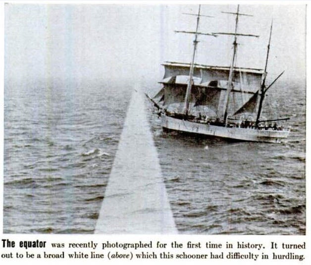
Fact: The Nazca lines are where the equator used to be.
|
HammerheadFistpunch
> For Sweden
04/16/2018 at 19:17 |
|
That was before they moved it to make shipping easier right?
 Wacko
> HammerheadFistpunch
Wacko
> HammerheadFistpunch
04/16/2018 at 19:27 |
|
I thought that’s why they really make kei-cars to drive along this road right?
|
HammerheadFistpunch
> Wacko
04/16/2018 at 19:30 |
|
kei = equator.
 crowmolly
> HammerheadFistpunch
crowmolly
> HammerheadFistpunch
04/16/2018 at 19:32 |
|
Pfft. They just weren’t using the schooner to its full potential. Should have just gotten a sloop.
 OPPOsaurus WRX
> HammerheadFistpunch
OPPOsaurus WRX
> HammerheadFistpunch
04/16/2018 at 19:37 |
|
fact: every country is a different color when viewed from high altitudes such as red yellow green and purple
|
HammerheadFistpunch
> crowmolly
04/16/2018 at 19:38 |
|
Jolly good!

 ttyymmnn
> HammerheadFistpunch
ttyymmnn
> HammerheadFistpunch
04/16/2018 at 19:45 |
|
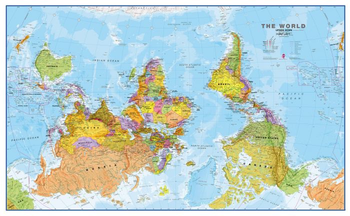
Maps are arbitrary constructs.
 Chariotoflove
> HammerheadFistpunch
Chariotoflove
> HammerheadFistpunch
04/16/2018 at 19:48 |
|
I learn so much on this site.
 ZHP Sparky, the 5th
> ttyymmnn
ZHP Sparky, the 5th
> ttyymmnn
04/16/2018 at 19:54 |
|
It’s a racist hierarchy drawn to keep the white man on top!
Actually, now that I actually think of this…
 Highlander-Datsuns are Forever
> ZHP Sparky, the 5th
Highlander-Datsuns are Forever
> ZHP Sparky, the 5th
04/16/2018 at 20:23 |
|
I’m like wow I’ve been thinking of north as up my whole life.
 functionoverfashion
> HammerheadFistpunch
functionoverfashion
> HammerheadFistpunch
04/16/2018 at 23:02 |
|
Aliens.
 davesaddiction @ opposite-lock.com
> ttyymmnn
davesaddiction @ opposite-lock.com
> ttyymmnn
04/17/2018 at 09:43 |
|
Your projection system is racist.
|
ttyymmnn
> davesaddiction @ opposite-lock.com
04/17/2018 at 10:19 |
|
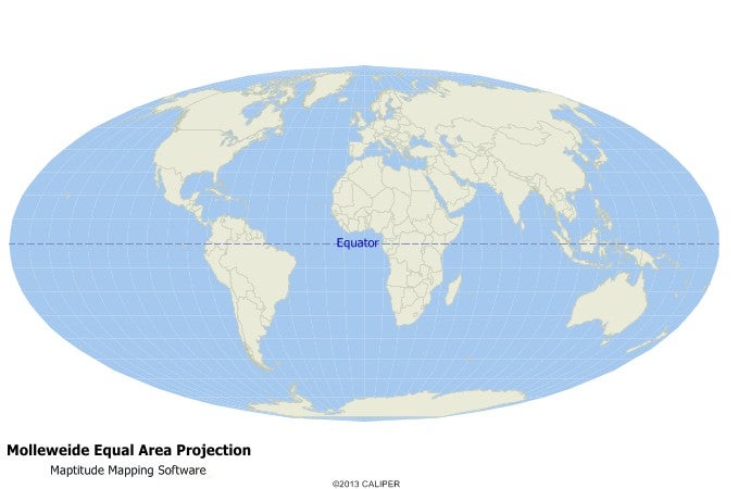
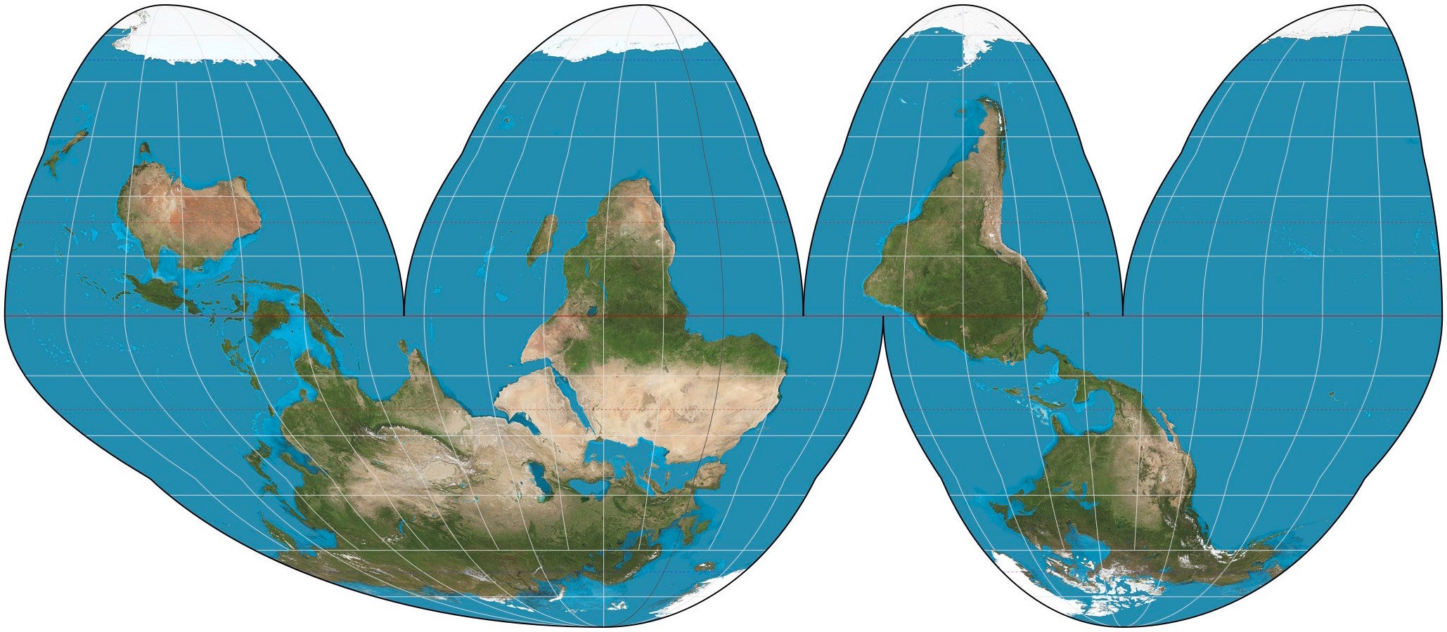
Would you prefer the Goode homolosine projection?
|
davesaddiction @ opposite-lock.com
> ttyymmnn
04/17/2018 at 10:21 |
|
That’s pretty Goode.
|
ttyymmnn
> davesaddiction @ opposite-lock.com
04/17/2018 at 10:22 |
|
Mercator maps are lousy for representing the Earth, but dynamite if you are trying to sail across the ocean.
|
davesaddiction @ opposite-lock.com
> ttyymmnn
04/17/2018 at 10:25 |
|
“just follow this line”
|
davesaddiction @ opposite-lock.com
> ttyymmnn
04/17/2018 at 10:27 |
|
Mercator maps: also good for Greenlanders’ self-worth